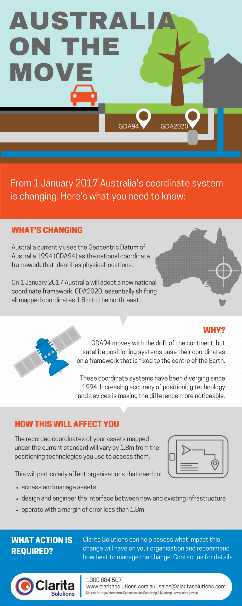
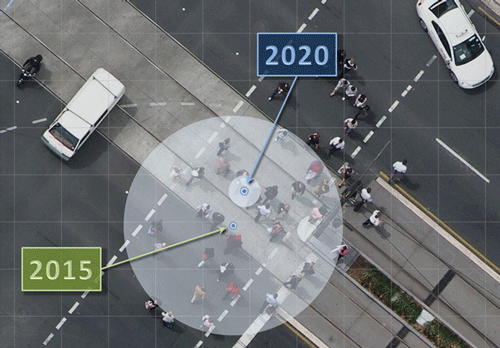
Australia is on the move. By 2020 the continent will have drifted 1.8 metres from its position in 1994 when the current standard for recording location coordinates was established.
On 1 January 2017 that standard (the Geocentric Datum of Australia 1994 or GDA94) will be replaced by GDA2020, bringing our national coordinate framework into line with the global framework which supports new technologies such as satellite positioning systems.
For many, this change will simply mean more accurate GPS data when using a smartphone to navigate around town. For others, particularly those organisations involved in activities that rely on location and spatial data, such as building and construction, town planning, agriculture, landscape mapping, transport, or infrastructure/facilities management, adopting the new GDA2020 datum will require some updates to databases, systems and practices.
There’s a location element to nearly every aspect of asset management, and the implementation of GDA2020 will be particularly relevant for asset managers who maintain assets that are buried underground, or engineer new infrastructure in existing built environments.
Clarita Solutions (a COSOL Company) put together this infographic, providing the highlights you need to know about Australia’s shift to GDA2020.
The Intergovernmental Committee on Surveying and Mapping (ICSM) is responsible for modernising Australia’s datum. An excellent collection of resources and Frequently Asked Questions has been compiled on their website which is recommended reading for anyone keen to learn more, in particular:
- Australia’s datum modernisation: what you need to know fact sheet
- Modernising Australia’s Datum video
Adopting GDA2020 will be a progressive process, commencing early in 2017. COSOL is offering a GDA2020 readiness assessment for organisations keen to understand their risk profile and options for implementation.


